Conservation Monitoring: The Scientific Backbone of Daily Protection
If you want to protect Endangered and Priority species, the first and most vital step is simple: you have to know where they are. This is the driving mission behind all Wildlife ACT field work in Zululand's Protected Area every day.
By integrating innovative wildlife Monitoring technology, such as GPS collars, satellite transmitters, and radio telemetry tracking, we locate specific Individuals and collect critical real-time data on movement patterns, behavior, and health, enabling science-driven decisions that deliver tangible conservation outcomes.
It is the indispensable link between our field teams and the African Wild Dog or the Black Rhinoceros that needs safeguarding. This entire process is about turning an animal's location into usable information for Endangered and Priority species Monitoring.

The Monitoring Tools
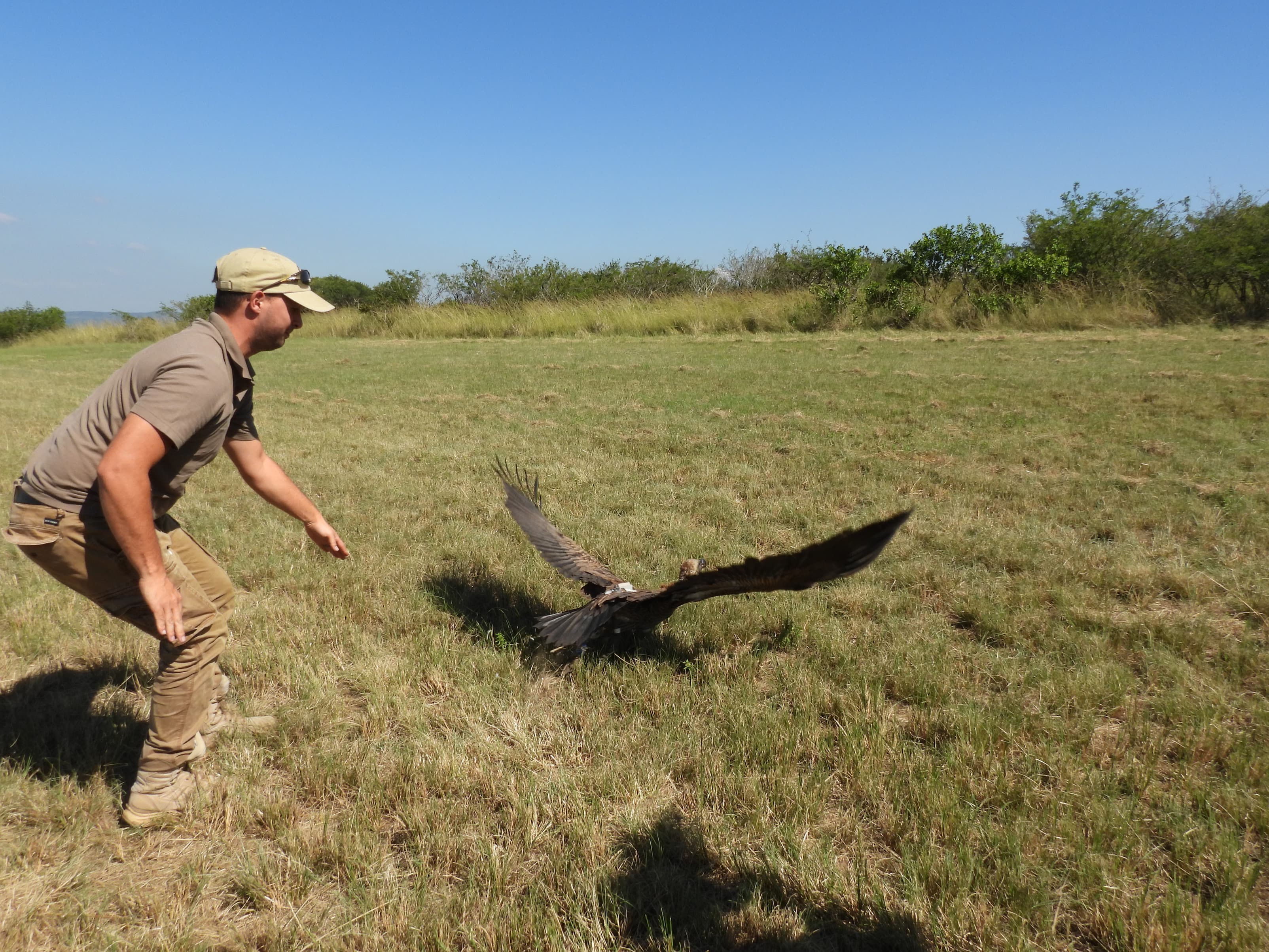
The process begins when a Monitoring device or equipment is expertly fitted to an Individual. This device is engineered to broadcast a radio signal via Very High Frequency (VHF) or to transmit detailed location data using advanced protocols.
These protocols include Satellite, LoRA, or the GSM (Cellular Network). For a professional, science-driven organisation like Wildlife ACT, this constant data stream is the foundation of our entire Monitoring program. VHF remains crucial for the hands-on, daily verification, but the strategic, long-term Monitoring is increasingly driven by remote data transmission via Satellite and LoRA technology.
Without this technological layer, we cannot effectively monitor movements, detect immediate threats, or measure the long-term success of crucial reintroduction efforts. This is hands-on, purpose-driven conservation work.
We rely on two main technologies. First is the hands-on VHF radio telemetry, which requires monitors to manually "listen" for a unique signal. Second is the sophisticated GPS collar, which automatically captures and sends rich data remotely.
Both systems demand patience, skill, and an expert understanding of wildlife behaviour to be used effectively in the rugged Zululand environment. This article will show you how we deploy these technologies, and crucially, what your practical, day-to-day role as a wildlife volunteer will involve in mastering this essential conservation science.
VHF Telemetry vs GPS Collars: The Tools of the Trade
Monitoring Endangered and Priority species is a strategic challenge. It requires a constant balancing act involving battery life, project budget, and the sheer volume of data we need to make smart decisions.
For this reason, Wildlife ACT does not rely on a single technology. Instead, we strategically use two distinct systems. These systems are VHF radio telemetry and GPS collars. We use them to monitor Endangered and Priority species such as the African Wild Dog and the Black Rhinoceros across multiple Zululand Protected Area . Understanding these differences is fundamental to the wildlife Monitoring program you will join.
Understanding these differences is fundamental to the Monitoring programme you will join.
VHF Radio Telemetry: The Hands-On Approach
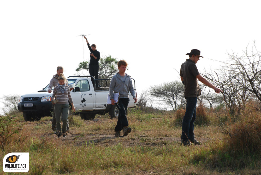
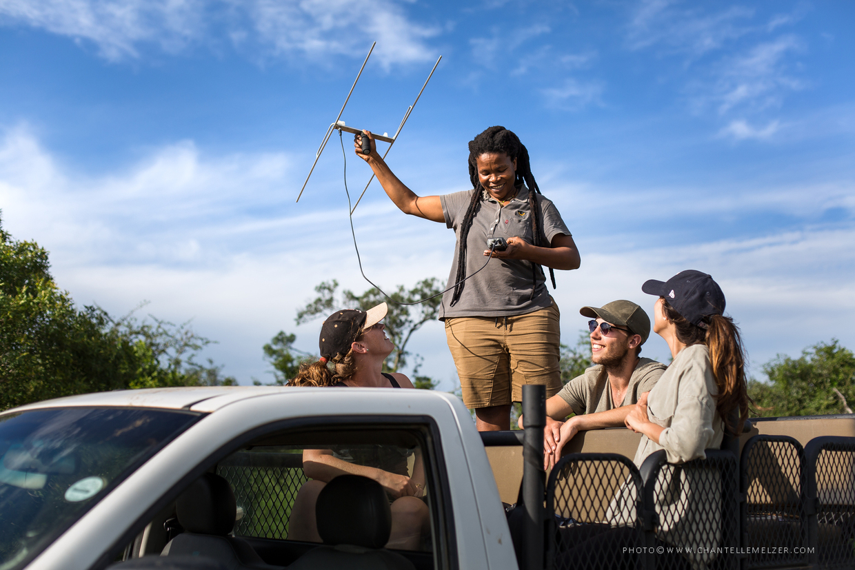
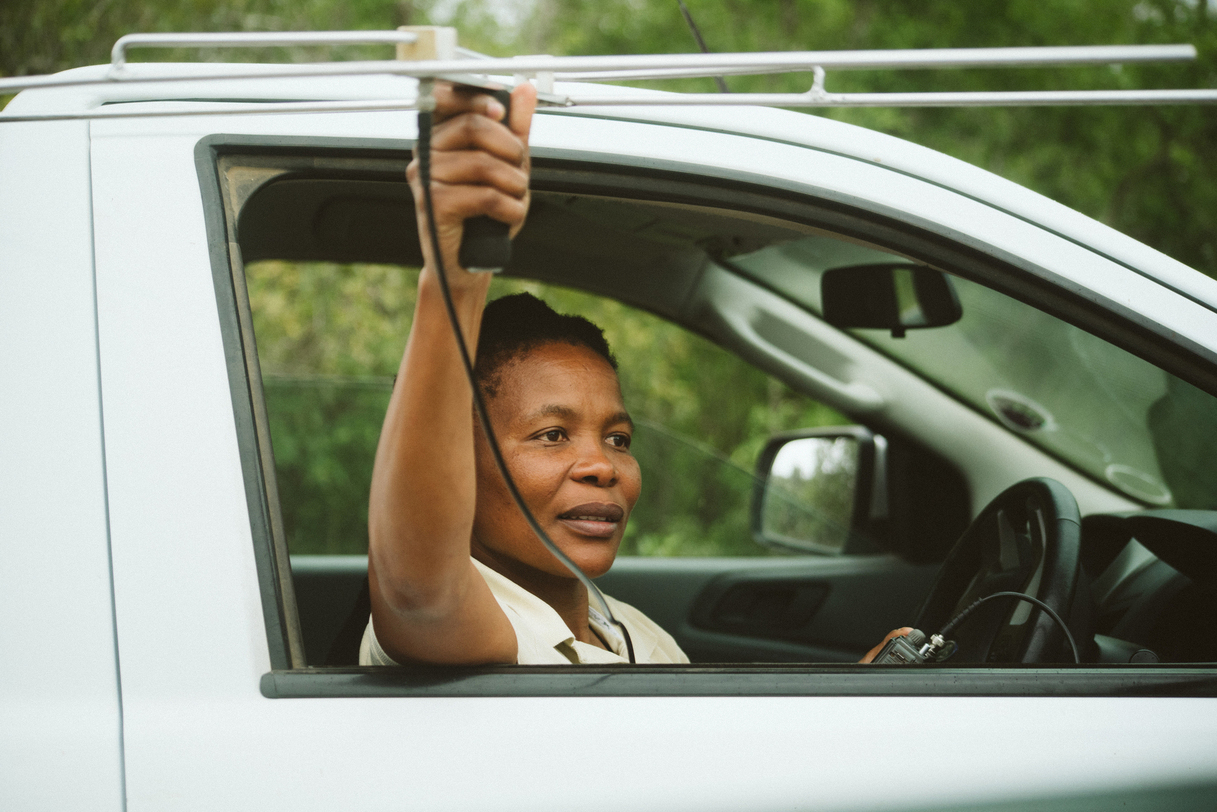
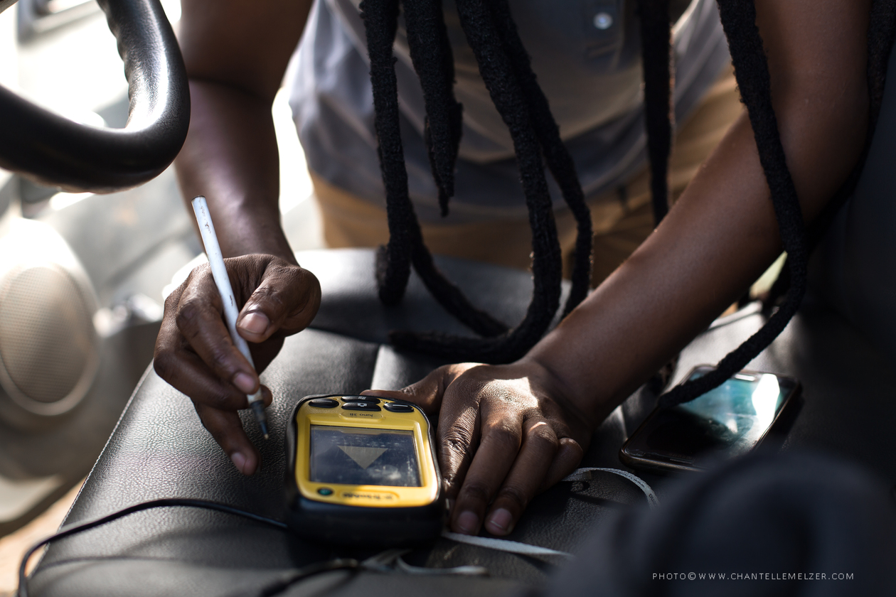
Very High Frequency, or VHF, telemetry is the traditional and most reliable method used in the bush. It involves a simple transmitter attached to the Individual, which emits a constant, specific radio frequency. The monitor uses a directional antenna and a receiver to manually pick up this unique, rhythmic beeping signal.
The greatest strengths of VHF technology are its low cost and extended battery life, often lasting for years. Crucially, it is a hands-on method that demands active participation and high skill from the monitor. You have to physically move through the protected area, often for hours, to triangulate the signal and determine the animal's exact location.
This method requires patience. Signals can be affected by weather, terrain, and dense vegetation. The core skill is interpreting changes in the signal strength to successfully find the Individual and gather the necessary ecological data for wildlife telemetry.
GPS Collars: The Data Advantage
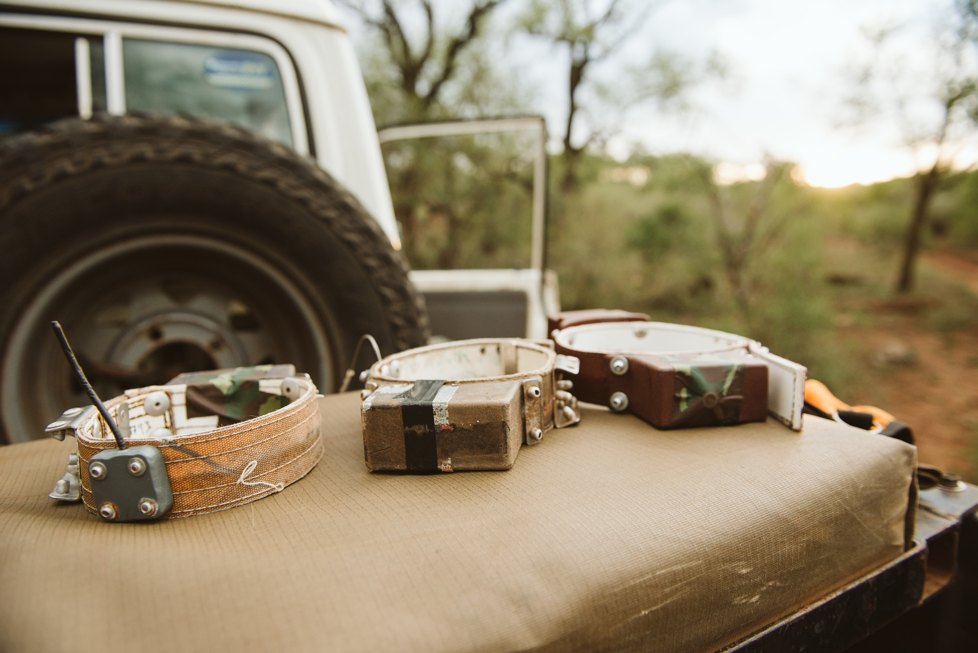
GPS collars are the most technologically advanced tool in our arsenal. These collars contain a miniature GPS unit that automatically records and stores numerous location fixes throughout the day. This data is then either downloaded manually or transmitted remotely via Satellite, LoRA, or GSM (Cellular Network).
The advantage of a GPS collar is the sheer volume of data it collects. It provides a detailed track of an Individual’s movements, allowing monitors to analyse patterns in home range use, hunting routes, and den locations from the office. For elusive species or those in difficult-to-access Protected Area , the remote data stream is invaluable for protection. Remote transmission via Satellite and LoRA is essential for long-term ecological analysis and providing real-time security alerts over vast, inaccessible areas.
However, this sophistication comes with trade-offs. The intense power requirement means GPS collars have a shorter battery life and are significantly more expensive to deploy and maintain than VHF tags. For this reason, they are typically fitted only to specific, high-priority Individuals, such as the alpha female of an African Wild Dog pack.
Combining the Technologies
Wildlife ACT often uses the two systems in tandem. GPS data provides the broad picture of an Individual’s range and movements, informing strategic planning. In contrast, VHF is the method used daily on the ground. When GPS coordinates indicate a potential issue, such as an animal remaining stationary for an unusually long time, monitors use the reliable VHF signal to pinpoint the Individual and verify its health and status immediately. This combined approach ensures both broad scientific coverage and direct, real-time protection in the field.
.jpg)
The Daily Process of Telemetry: How Field Monitoring Works
The reality of conservation Monitoring is far removed from a desk job. It is driven by dedication, early mornings, and a scientific process. Every day in the Protected Area of Zululand begins with monitors and volunteers gathering data on the location, health, and social dynamics of Endangered and Priority Species. This systematic approach ensures that the data collected is accurate and actionable.
-Step 1: Locating the Signal
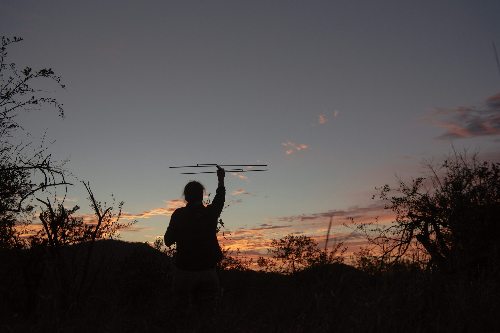
The first step each morning involves a systematic search for the target Individual or pack. Monitors often drive to a high vantage point to pick up the VHF frequency. Using the receiver and a directional antenna, the team slowly scans the horizon, listening for the distinctive beep of the collar. This requires immense focus, as the signal can be faint and easily masked by static or the protected area’s natural sounds.
Once a signal is picked up, the monitor uses a process called triangulation. They take a bearing from the first point, drive a known distance, take a second bearing, and then, ideally, drive to a third point for a final bearing. The intersection of these three lines on a map, or in a GPS application, indicates the approximate location of the Individual.
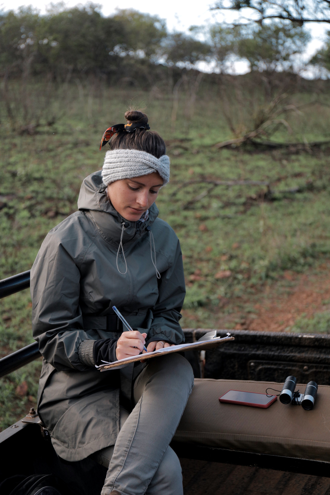
-Step 2: Confirmation and Data Collection
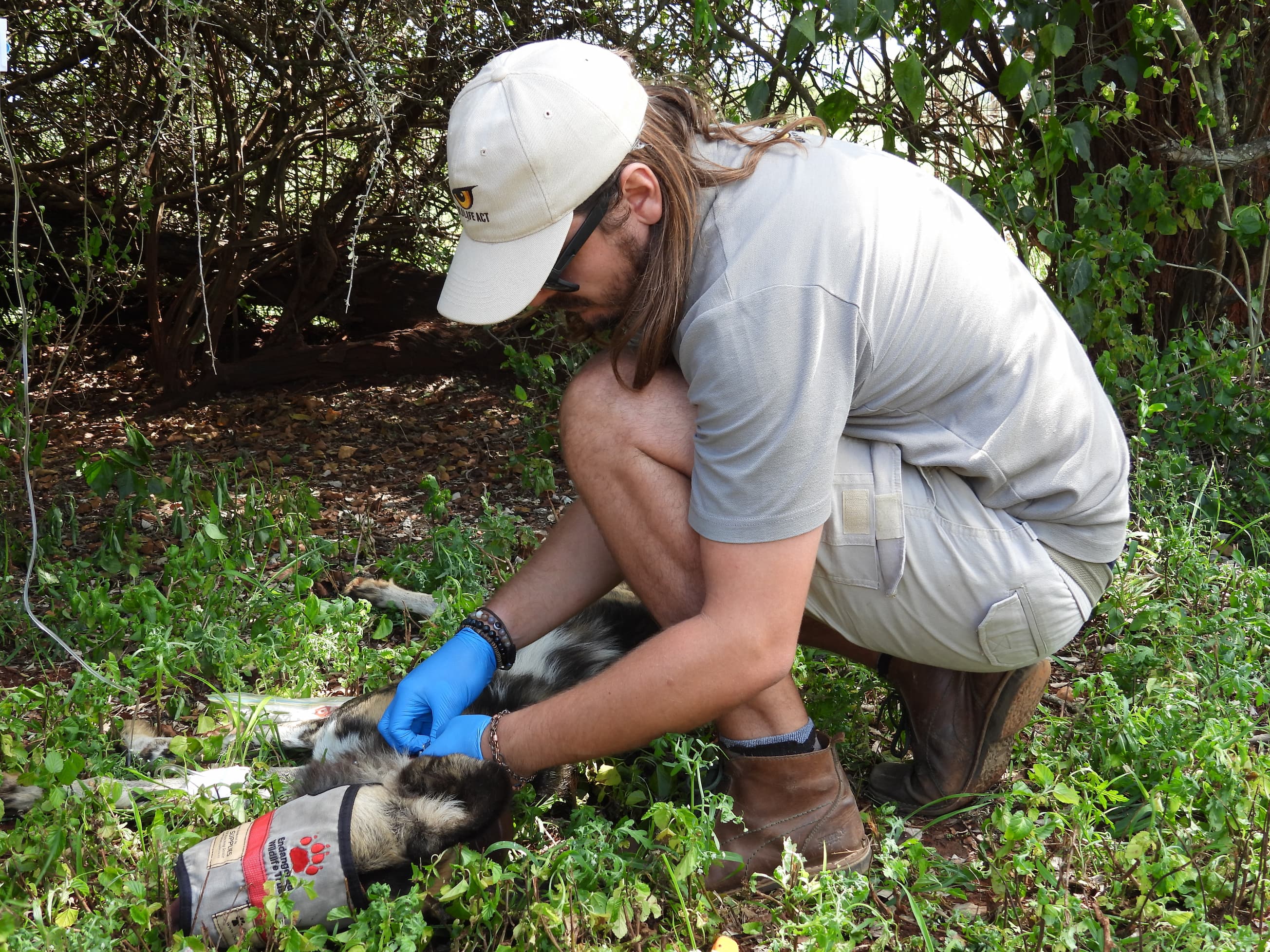
Pinpointing the location is only half the job. The priority is to confirm the sighting and check the Individual’s health and status.
For African Wild Dog, this means observing the pack size, noting if any Individuals are missing, and confirming if they have made a kill.
For the Black Rhinoceros, it involves checking for signs of stress or injury and collecting unique ID shots for identification records.
This crucial data is recorded onto standardised field data sheets. Accuracy is paramount.
Every observation, from the colour of an Individual’s ear tag to its general body condition, is carefully documented. This raw data is later uploaded to the central conservation database for long-term analysis.
-Step 3: Interpreting Behavioural Shifts
Telemetry does more than just locate. It alerts monitors to potential problems.
Wildlife volunteers play an essential role in this process by learning to interpret these subtle cues and assist the monitors in reacting swiftly. This makes it an ideal conservation course opportunity.
Therefore, this hands-on process is where the raw data is turned into effective, real-time conservation action.
Ready to apply the knowledge you've just gained? Unlock our Telemetry Cheat Sheet below.
The Conservation Impact: Turning Location Data into Protection Strategy
Why do we spend hours listening for that faint signal? Because the daily Monitoring is never an end in itself. It is the critical data that feeds into high-level management and security decisions. The information gathered via telemetry, specifically location, movement, and behavioural observations, is analysed to create pragmatic, purpose-driven conservation strategies for Endangered and Priority Species.
Defining Home Range and Ecology
Telemetry data allows monitors to map the exact home range of Endangered and Priority Species like the African Wild Dog or Cheetah. By logging thousands of data points, conservation managers can understand precisely how the Individual uses the protected area, identifying vital corridors, key feeding grounds, and potential breeding locations.
This ecological insight is critical when Protected Area need to make decisions about habitat management or infrastructure development.
For example, Monitoring a pack of African Wild Dogs reveals their average daily travel distance and hunting success rate. This directly influences management decisions, such as whether prey species need to be introduced or removed from the protected area.
Real-Time Security and Early Warning
Perhaps the most urgent application of telemetry is in anti-poaching solutions, security and promoting human-wildlife coexistence by preventing breakouts (or early response to these) as well as general emergency response (snares and poisonings)
GPS collars, especially those fitted to high-value Individuals like the Black Rhinoceros, provide an essential early warning system by transmitting data via Satellite and LoRA. If a GPS collar suddenly shows movement towards a fence line or an area known for illegal activity, the response team can be alerted immediately.
Furthermore, the GPS data builds a baseline of normal movement patterns. Any deviation from this baseline, such as an unusual stop in a remote area or movement at a time the Individual is usually resting, signals a potential threat.
This technological layer of protection is invaluable to the protected area’s security team.
Informing Translocation and Recovery
Wildlife ACT frequently uses telemetry data to determine the success of reintroduction and translocation programmes. When a pack of African Wild Dogs is moved to a new protected area, the team relies heavily on the collared Individuals to monitor their adaptation. Monitoring their stress levels, social cohesion, and ability to establish a new home range is only possible through consistent signal tracking.
The Monitoring data collected is shared with management authorities in both raw form and detailed monthly reports . This ensures that conservation decisions, from veterinary interventions to habitat selection, are always based on current, reliable, and scientifically sound information.
The Wildlife Volunteer’s Role: Mastering Telemetry and Field Skills
Telemetry Monitoring is your direct gateway to real conservation experience. As a wildlife volunteer, you are placed directly alongside Wildlife ACT's professional monitors. You gain hands-on expertise in using this essential scientific tool. Your role is not just to observe; it is to actively participate in every step of the data collection process, building skills that are valuable in any future conservation training career.
Developing Field Proficiency
The first and most important skill you master is the practical use of the VHF telemetry equipment.
This includes:
- learning to tune the receiver to the correct frequency,
- correctly positioning the antenna for optimal signal reception, and
- learning to interpret the subtle changes in the beeping that indicate distance and direction.
Furthermore, volunteers participate in the physical act of triangulation. This involves precisely marking bearings on a map or digital device and working with the monitor to navigate the vehicle, often off-road, to the target location.
This practical experience is where the theory of conservation meets the reality of fieldwork.
Data Accuracy and Accountability
Once the Individual or pack is located, your role shifts to accurate data collection. You are trained to complete standardised data sheets, recording observations on everything from social interactions and feeding behaviour to specific Individual health checks.
The responsibility of ensuring data integrity is a core part of the experience. Accurate, unbiased, and systematic data recording is what separates conservation Monitoring from general wildlife viewing.
Wildlife volunteers learn that the quality of their data directly impacts the protected area's management decisions.
Understanding Wildlife Behaviour
Mastering telemetry quickly allows volunteers to develop a deeper understanding of animal behaviour and ecology.
By consistently Monitoring the same individuals, you begin to anticipate their movements, understand their social structure, and interpret their responses to the environment.
For example, learning the difference between a pack of African Wild Dogs resting versus a pack on the move informs both Monitoring strategy and ecological insight.
This is the experience-based learning that defines the Wildlife ACT programme.
To deep dive into the full, hands-on experience, read our comprehensive blog post https://www.wildlifeact.com/blog/how-to-contribute-to-hands-on-conservation-in-zululand
Frequently Asked Questions (FAQ)
1. What type of data is collected on Endangered and Priority species?
We collect location, health, and behavioural data. Location data (GPS/VHF) maps home ranges, while health checks confirm body condition and potential injuries. Behavioural observations detail social interaction, feeding success, and potential breeding activity. All of this feeds into management decisions.
2. Do tracking collars harm the Endangered species?
No. The collars are developed with Wildlife ACT Innovations to be lightweight, balanced, and durable. They are fitted during a quick, supervised immobilisation procedure. The goal is to collect essential data for protection with minimal impact on the Individual's behaviour or movement.
3. What is signal triangulation in conservation Monitoring?
Signal triangulation is the process of taking multiple compass bearings on a VHF radio signal from different known points. By plotting these intersecting lines on a map, the team can accurately pinpoint the approximate location of the Individual without having to physically see it. This technique is fundamental to effective Monitoring in dense African bush.
4. How does a GPS collar transmit data from remote areas?
GPS collars record locations, but the transmission method depends on the model. In remote areas of Zululand, data is often sent using satellite networks like Iridium or through GSM mobile phone networks. The collar stores data until a signal is available and then uploads the entire batch. This ensures continuous, valuable data collection even when Individuals are far from human access or Monitoring bases.
5. Why do you Monitor movement patterns instead of just counting the species?
Monitoring movement patterns is crucial because it provides detailed ecological data far beyond a simple population count. This data reveals an Individual's home range, habitat use, interaction with other species, and breeding success. Analysing these movements helps conservation managers make informed decisions on territory management, habitat restoration, and security placement, all of which directly support species recovery.
Ready to Apply the Science?
Telemetry is much more than technology. It is the scientific backbone of Endangered species protection.
From the early morning search for a faint VHF signal to the long-term analysis of GPS movement patterns, every action directly contributes to the security and management of African Wild Dog, Black Rhinoceros, and other priority species across Zululand.
We have seen that the field work requires dedication, and turns raw location data into essential conservation strategies, whether by defining a home range or triggering an anti-poaching response.
The skill of interpretation and accurate data collection is what truly makes this work meaningful and impactful.
The need for highly skilled monitors and robust data collection is constant.
By joining a Wildlife ACT team, you are not simply Monitoring animals. You are taking on the hands-on responsibility of using a scientific tool that dictates the future of these threatened populations. It is an opportunity to contribute directly to the credibility of our entire conservation effort.
Take Action: If you are ready to move beyond simple observation and contribute to critical data collection, explore how you can become a part of the Wildlife ACT Monitoring program. For those seeking an Africa volunteer experience, this is the perfect fit.
Your participation is the direct investment that keeps our monitors, in the field and the collars working to protect the most vulnerable species.

References:
Wildlife ACT. (n.d.). Endangered wildlife tracking and monitoring. https://www.wildlifeact.com/about-wildlife-act/endangered-wildlife-tracking-monitoring
Wildlife ACT. (n.d.). GPS and VHF wildlife tracking collars used for monitoring. https://www.wildlifeact.com/blog/gps-and-vhf-wildlife-tracking-collars-used-for-monitoring
Wildlife ACT Innovations. (2021). A guide to wildlife tracking technologies. https://wildlifeactinnovations.com/wp-content/uploads/2021/05/A-Guide-to-Wildlife-Tracking-Technologies.pdf
%20(2).jpg)