%20(2).jpg)
Conservation has changed dramatically over the past decade. Across Africa’s protected areas, conservation teams are no longer relying solely on field observations, traditional telemetry systems, analog radio communication, and manual reporting to monitor wildlife and respond to threats. Today, conservation increasingly depends on connected systems, near real-time data, and operational awareness across large and often remote landscapes.
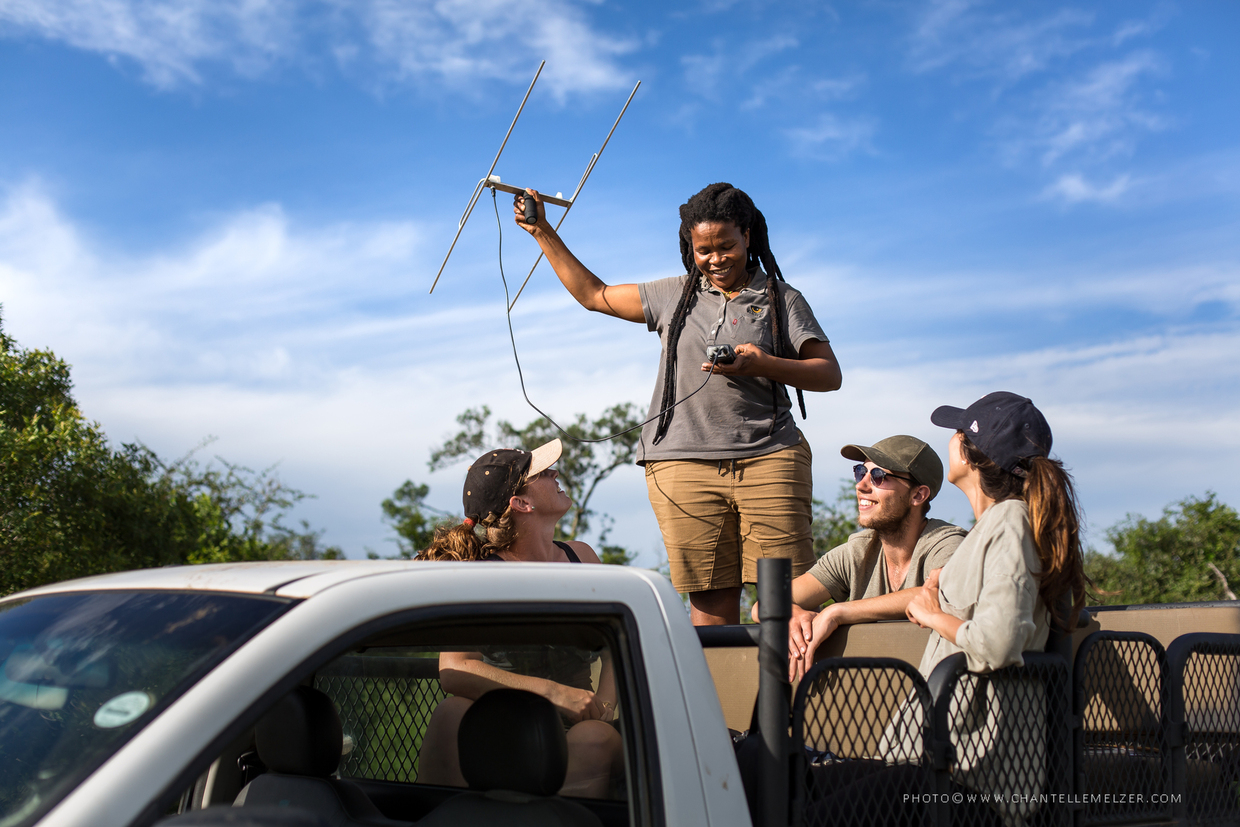
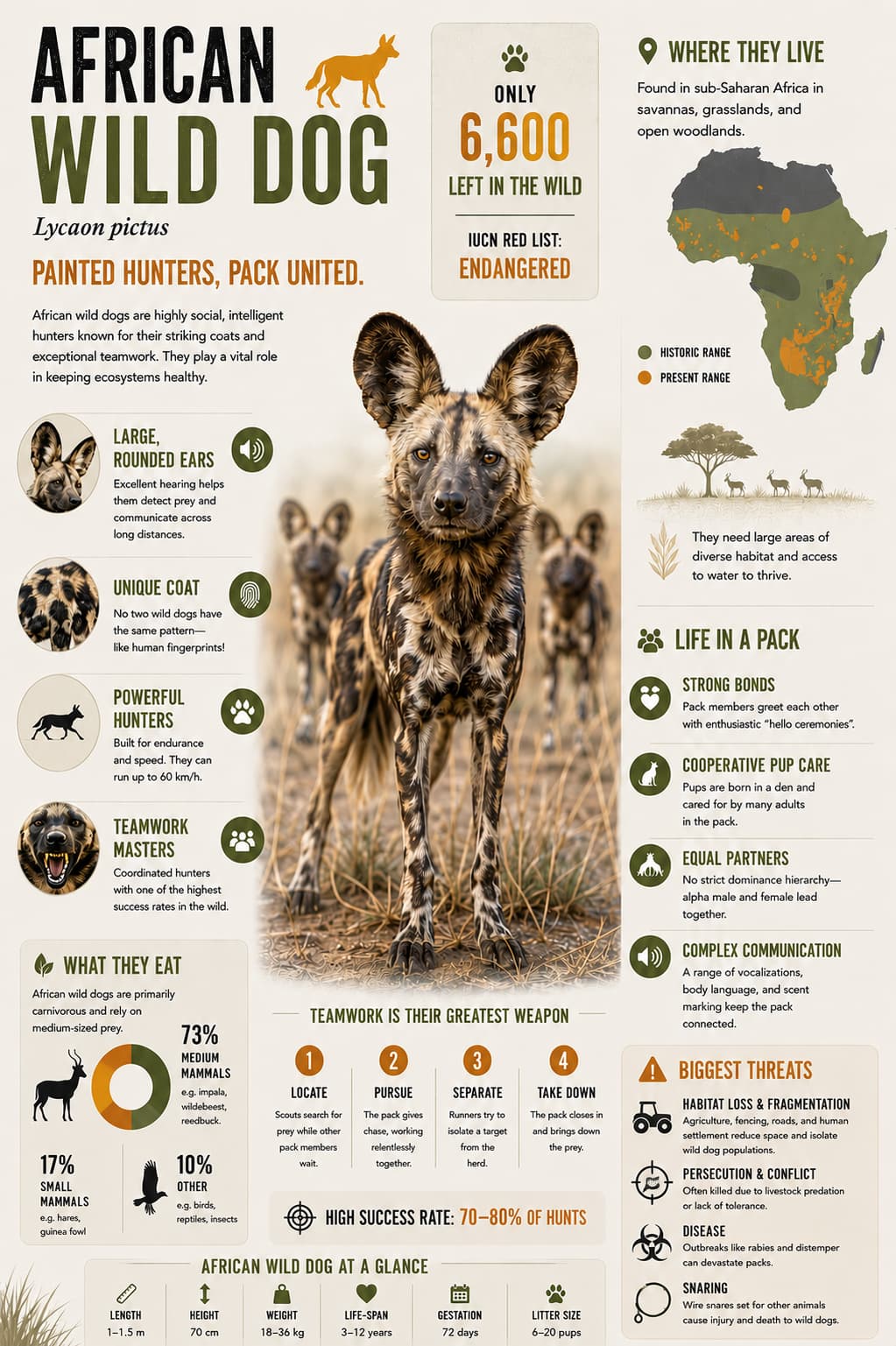
This shift is particularly important for species such as African Wild Dogs, one of the continent’s most endangered carnivores. Wild dogs move across enormous distances, navigate complex landscapes, and frequently operate beyond the boundaries of protected areas. Monitoring these movements in near real time has become a critical component of modern conservation operations.
In landscapes such as Zululand in northern KwaZulu-Natal, conservation teams are increasingly using technology to improve visibility across large and often difficult-to-monitor areas. Real-time tracking and improved operational awareness often help teams respond more quickly when wild dogs move out of protected areas and toward neighbouring local communities, where the risk of human-wildlife conflict becomes significantly higher.
This is becoming increasingly important in areas where people and wildlife share the same landscape. Faster access to movement data helps conservation teams reduce the risk of livestock predation, supports safer coexistence, and improves protection for endangered species such as African Wild Dogs. While technology is not a solution on its own, it has become an important tool that helps conservation teams make quicker and better-informed decisions in the field.
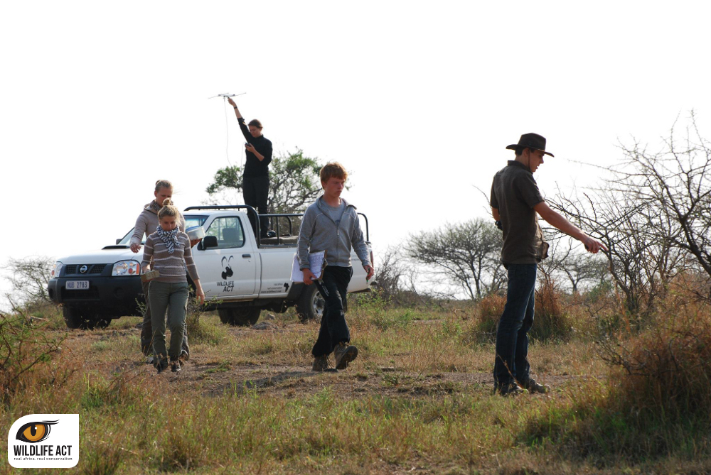
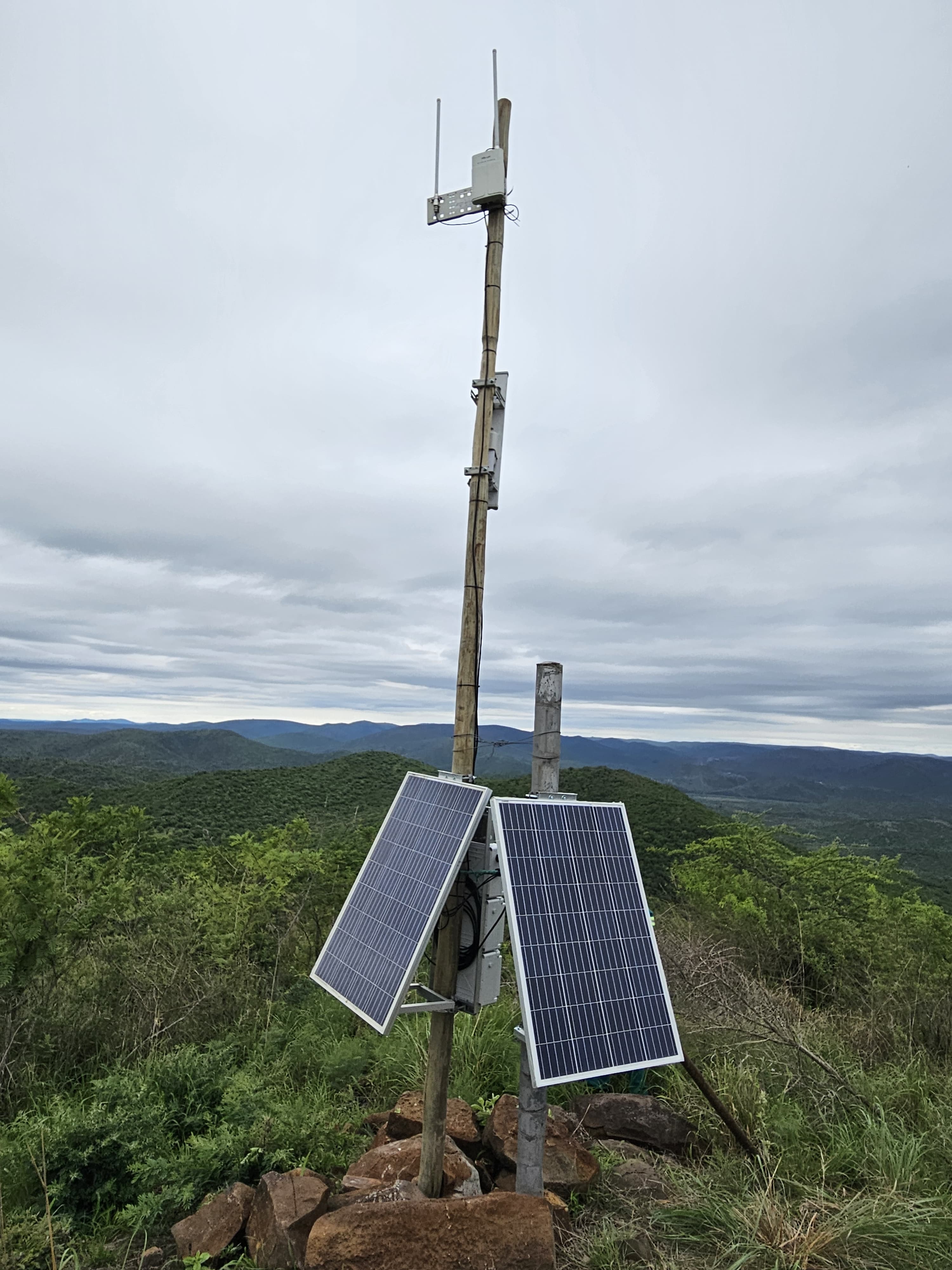
At the centre of this transformation is the growing use of connected IoT conservation systems powered by LoRaWAN technology, sensor networks, and real-time data analysis.
%20(3).jpg)
The Power of IoT Technology in Modern Conservation
LoRaWAN, short for Long Range Wide Area Network, is an IoT (Internet of Things) technology that uses low-power wireless communication to enable data transmission across large and often remote geographic areas. A simple way to think about it is as a highly scaled-up version of your home Wi-Fi network, designed to operate across entire landscapes rather than a single building. This makes it particularly well suited to conservation areas where traditional communication infrastructure is limited or unavailable.
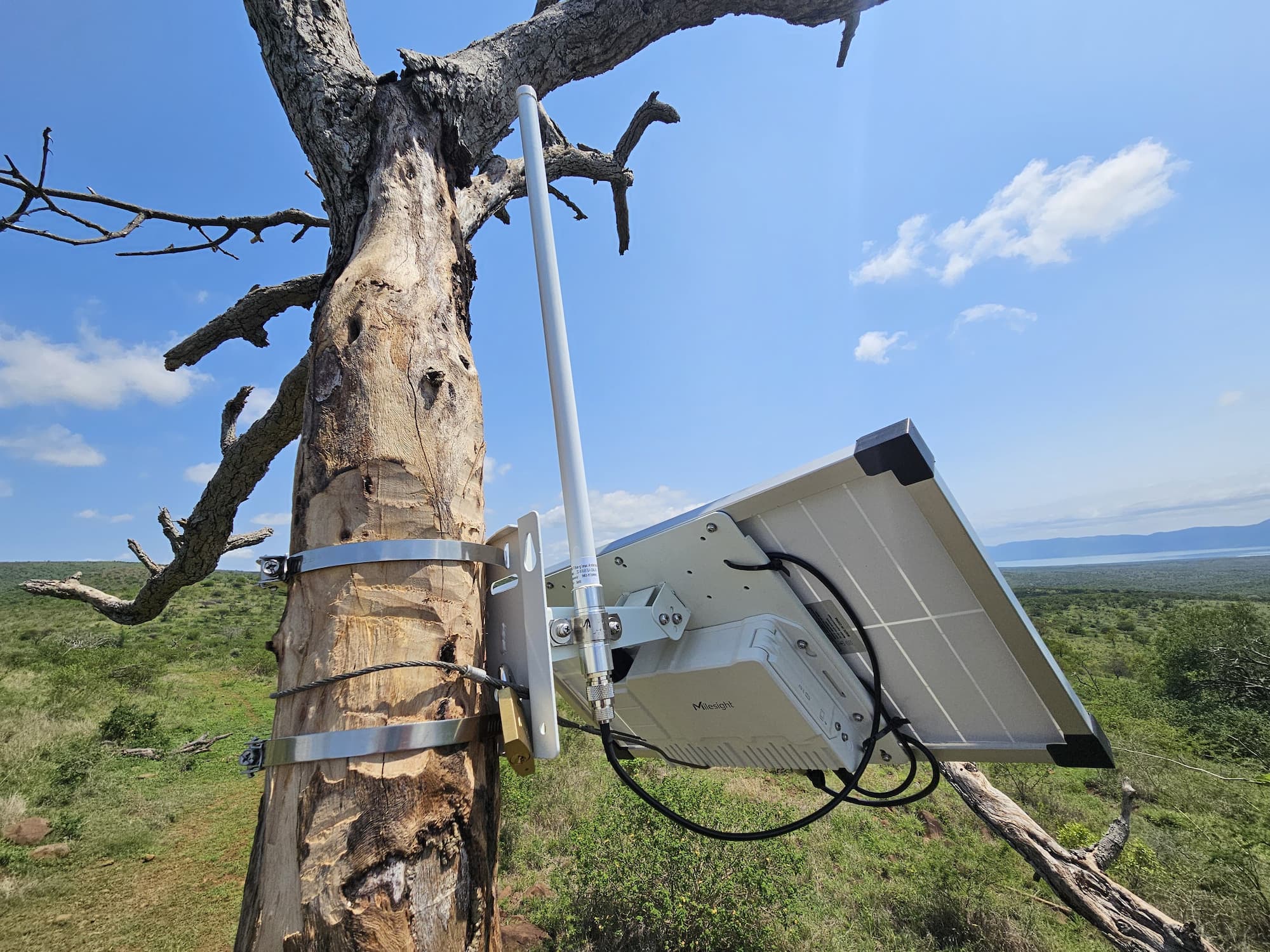
In practical terms, LoRaWAN allows sensors and tracking devices fitted to wildlife to send location and movement data back to central monitoring systems through LoRaWAN gateways strategically positioned on elevated sites across a protected area. These gateways, similar in concept to a home Wi-Fi router but significantly more powerful and purpose-built for long-range coverage, can provide connectivity across several hundred square kilometres depending on terrain and environmental conditions. This allows tracking collars and field sensors operating across vast geographic areas to transmit data into mapping platforms, operational dashboards, and monitoring systems in near real time. The technology effectively creates a connected layer of visibility across the landscape.
A useful way to think about LoRaWAN is as a digital nervous system operating quietly in the background of conservation operations. Information collected in remote areas can now be transmitted, visualised, and analysed in near real time, allowing conservation teams to respond more efficiently and with greater situational awareness.
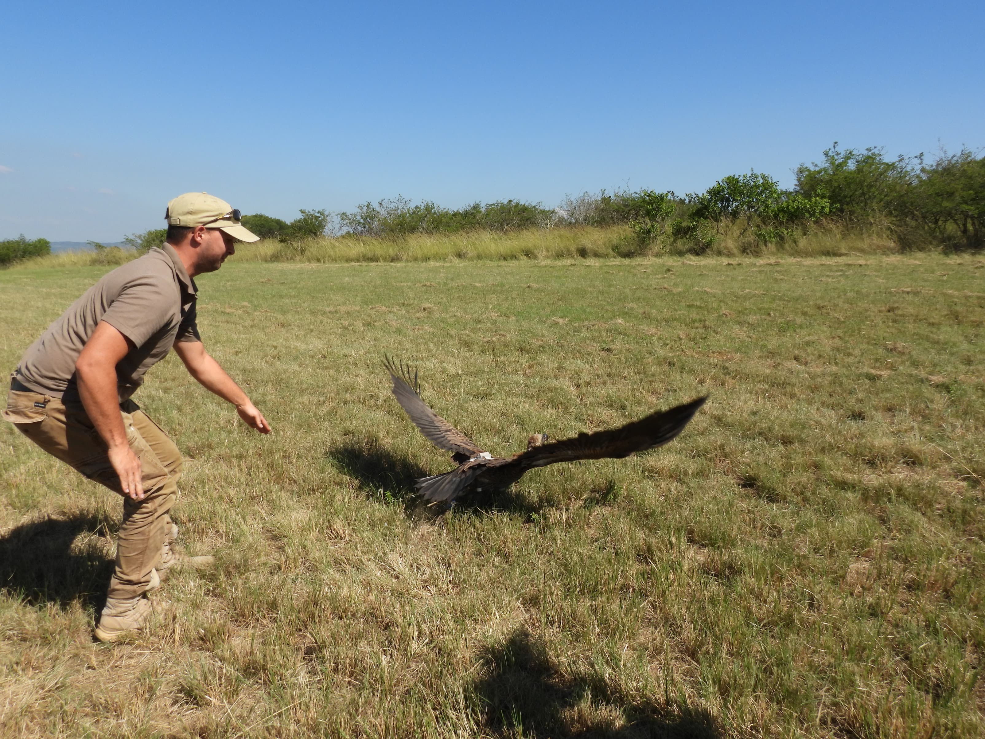
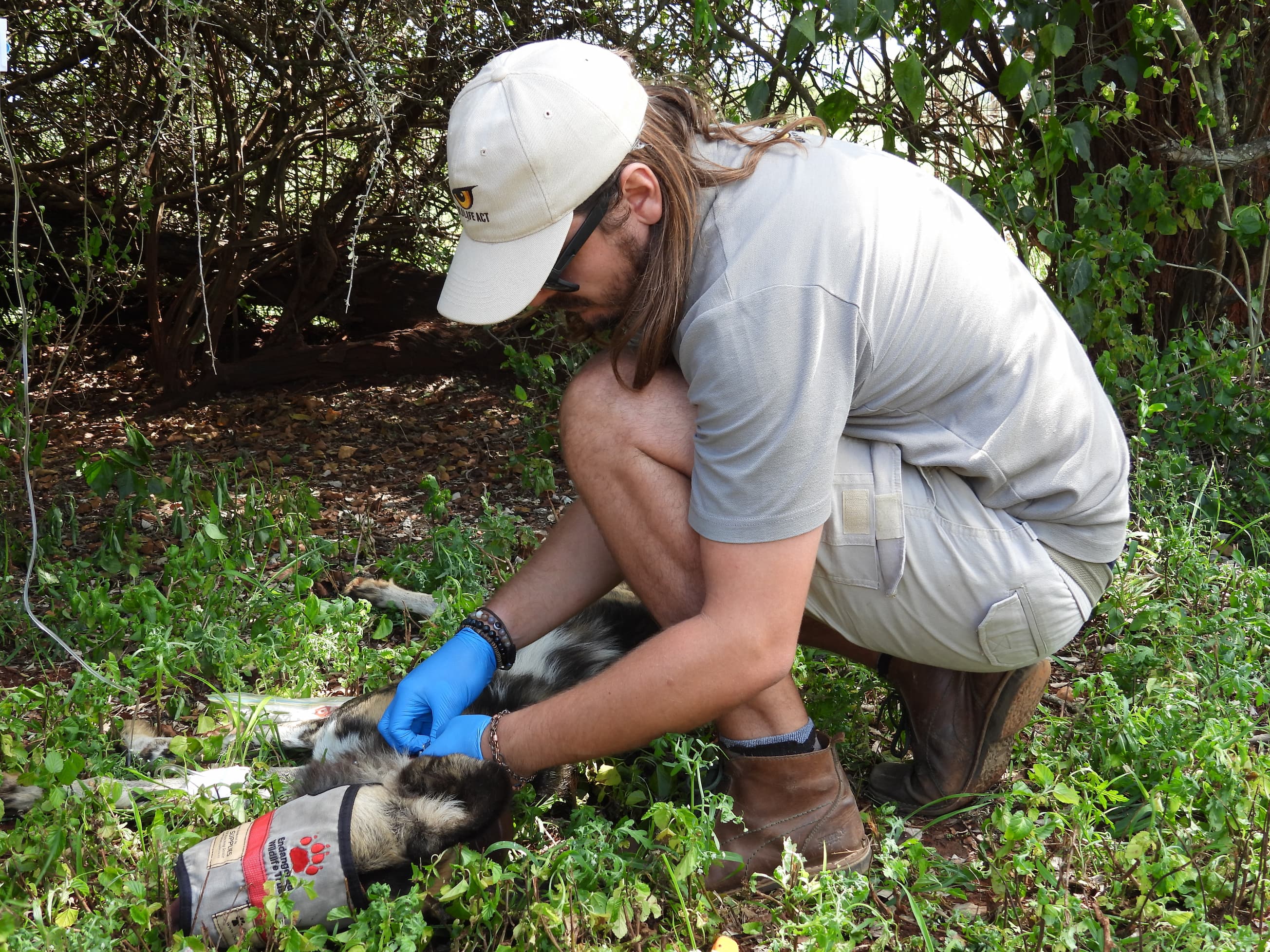
Tracking African Wild Dogs Across the Landscape
African Wild Dogs are one of Africa’s most fascinating predators, but they are also one of the most challenging species to monitor effectively.
Unlike territorial predators that occupy relatively fixed areas, African Wild Dogs are highly mobile and capable of covering vast distances in short periods. Their movements are influenced by prey availability, competition, denning behaviour, landscape connectivity, and human pressures beyond protected area boundaries. This creates significant operational challenges for conservation teams.
.jpg)
Tracking systems supported by connected sensor networks allow monitoring teams to better understand how packs move through the landscape and how they utilise different environments over time.
Real-time tracking data can assist teams in:
• Monitoring pack health and movement
• Understanding habitat use
• Identifying dispersal behaviour
• Detecting movement toward high-risk areas
• Supporting coordination between protected areas and monitoring teams
Near real-time movement alerts can help conservation teams respond quickly when wildlife begins moving out of protected areas and toward neighbouring farms or local communities. Access to movement data allows teams to intervene before conflict occurs, whether by deploying ground teams to help guide the animals back into protected areas or, in more serious situations, using helicopter support to dart and safely return the animals. This helps reduce the risk of livestock predation and retaliatory killings of wild dogs by farmers, while improving long-term coexistence planning across shared landscapes.
The value of these systems is not simply about “seeing dots on a map”. The real value lies in how the information supports decision-making in the field.
Turning Data into Actionable Intelligence
Collecting data is only one part of the process. The real challenge is transforming large amounts of information into operational intelligence that conservation teams can use effectively.
Modern conservation systems increasingly combine tracking data, GIS mapping, camera traps, data visualisation dashboards, and integrated monitoring platforms into a single operational environment. Instead of relying on isolated data sources, conservation teams can now visualise multiple streams of information together.
This may include:
• Animal movement data
• Environmental conditions
• Infrastructure status
• Ranger patrol information
• Geospatial mapping layers
• Incident reporting systems
When combined, these systems provide a clearer understanding of what is happening across the landscape at any given moment.
Supporting Real-Time Conservation Operations
The development and deployment of advanced conservation technology systems require long-term investment, collaboration, and ongoing support. Building and maintaining complex technical infrastructure in remote environments is rarely simple, and keeping these operational systems running across large landscapes requires continued commitment from conservation organisations, technical teams, and support partners alike.
Importantly, these technologies are not about replacing people. Conservation will always depend on dedicated teams working on the ground, often in difficult conditions and across vast landscapes. Technology simply provides those teams with better tools, faster access to information, and improved operational awareness.
Support from Science Based Ingredients (SBI) helps conservation teams implement and maintain advanced technologies that improve operational visibility and strengthen monitoring capabilities in the field.
Guided by its vision of supporting a more equitable and sustainable world, SBI’s investment in conservation technology is helping strengthen the protection of vulnerable species such as African Wild Dogs, while also supporting safer coexistence between wildlife and neighbouring communities whose livelihoods are closely connected to the surrounding landscape. By supporting practical, long-term conservation solutions on the ground, SBI is contributing to a future where both people and wildlife are better able to thrive together.
As conservation challenges continue to grow in complexity, landscape-wide connectivity and real-time data will play an increasingly important role in supporting the protection of endangered species such as African Wild Dogs. The future of conservation is no longer only about protecting wildlife within fenced protected areas. It is also about building smarter, more responsive conservation operations that can adapt to an increasingly dynamic world where wildlife, people, technology and shared landscapes are becoming ever more interconnected.